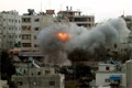
The first Palestinian village that you see to your left, after crossing the notorious Beit Hanoun (Erez) checkpoint in the semi-autonomous Gaza Strip, is Beit Hanoun. It is 8km north of Gaza city, and has 4769 inhabitants. As every where in Gaza, the most inter- esting historical building in Beit Hanoun is its mosque, Al-Nasr Mosque, which is situated on the left side, of the main road leading south to Gaza City. According to the foundation-inscription of the mosque, it was built in 1 637 (AD 1239) by the Emir Shams al-Din Sunqur, who is referred to in the inscription as 'Isfihsalar' (corresponding today to the title 'General ') in the army of the Ayyubid king al-Kamil. This mosque was built on the occasion of the victory of the Moslem army under the leadership of this Emir over the Crusaders who were under the leader- ship of Conte Henri de Bar. Close by is the burial place of the Moslem martyrs who fell in the battle. The mosque is built of sandstone and consists of three rooms. One of them is covered with a dome and the other two with cross vaults. New additions to the mosque have been made in later periods.
Seven kilometers north-west of Gaza, on the right of the road leading to Gaza City, is the village of Beit Lahya, 1015 inhabitants. Beit Lahya, or ancient Bethelea, is situated about 4km from the coast in a valley surrounded by sand dunes. The railroad which used to connect Cairo to Haifa, passes through the village; this railroad was stopped after the 1967 War. Beit Lahya is an important agricultural village in the Gaza Strip. Its inhabitants managed to reclaim much of the sand dunes and plant it with all kinds of veg- etables and fruit trees, especially the apple trees which the town is famous for. The village also produces large quantities of f1owers for export.
It seems that, the nowadays small village of Beit Lahya, was an important town during the Byzantine period. It is represented on the Byzantine mosaic map of Madaba in Jordan. Quantities of pottery and glass shards, as well as coins found on Beit Lahia's Tell al-Dahab, give evidence of a large Roman-Byzantine settlement on the Tell. It seems that 'Bethelea' was a well-populated village possessing several temples during the Roman period, prominent amongst them was a Pantheon, on the summit of the artificial mound of al-Dahab, which dominated the whole village. The name Bethelea may refer to this Pantheon.
JabalIya Camp and Village
The villages of Jabalya and al-Nazla are just north of Gaza City .The two small villages are dominated by Jabalya camp.
With a total population of over 83,000 inhabitants, Jabalya is the largest of all 28 official refugee camps of Gaza Strip and the West Bank. In 1996, the Palestinian Department of Antiquities discovered a large Roman-Byzantine cemetery on the western foot of the mound of Jabalya right on the right side of the main road from Gaza to the Beit Hanoun (Erez) checkpoint. The cemetery has two burial systems dating to the Roman and Byzantine periods. The first consists of collective tombs cut in the sandstone soil (kurkar), and the second burial system consists of individual surface graves also cut in the same kind of soil. They are generally oriented east west and are covered with slabs of sandstone. Many Roman-Byzantine pottery shards and oil lamps were discovered in the tombs as well as glass bottles, bracelets, gold earrings and a few gold coins of the 6th century AD.
About a hundred meters away from the cemetery, a mosaic r pavement was discovered by the same department in 1997. J The pavement seems to be part of a large Byzantine comp1ex including a church, halls and rooms for religious and domestic use; as we11 as a courtyard. The large dimension, of the complex and the high quality of its mosaic technique, the seventeen Greek inscriptions that were found there, as well as the precise details of its rich decorative motifs made it the most important Byzantine site discovered to date in the Gaza Strip. The oldest in scription found here, a partially damaged funerary inscription, dates back to AD 444. The date of the church is supposed to be earlier than this. Most of the other inscriptions are badly damaged. It is believed that the Roman Byzantine village 'Asalea" which is represented on the Byzantine mosaic map of Madaba, is located in the same spot of the present-day al-Nazla.
The mosaic pavement of the complex is made mainly of cubes of black basalt, marble, glass, red pottery and lime- stone. The main decorative elements are geometrical ele- ments, scenes of hunting, agriculture, fruits, food, pastoral life, animals and birds. Most of the human and animal figurines discovered were found damaged. These discoveries give the impression that a large Byzantine settlement, a large village, if not a small town, existed just north of the city of Gaza in the Byzantine period.
By: Dr. Adel Yahya, Dr. Muin Sadeq, Dr. Hanna Abdel Nour |